

Free text
ReWio Short
The atomic-clock mathematics behind the blue dot
Your phone can tell you where you are because it is extraordinarily good at answering one question: how late did a signal arrive?
That sounds almost too simple. Yet from a handful of faint radio signals arriving from space, a receiver can estimate its latitude, longitude, altitude, and time. It can do it while sitting in a car, on a hiking trail, or inside your pocket. The trick is not that the phone somehow sees itself on a map. The trick is that it listens to clocks in orbit, measures delays far smaller than a blink, and solves a geometric puzzle.
GPS, the Global Positioning System, is a United States-owned system that provides positioning, navigation, and timing. It has three parts. There is the space segment: satellites orbiting Earth and broadcasting signals. There is the control segment: ground facilities that track the satellites, monitor their clocks, calculate updates, and send new data upward. And there is the user segment: receivers in phones, cars, aircraft, surveying equipment, ships, and countless other devices.
Start with the satellites. Each GPS satellite continually transmits a radio signal. That signal contains two pieces of information that matter enormously. First, it tells the receiver where the satellite was when it sent the signal. Second, it tells the receiver the exact transmission time.
The receiver notes when the signal arrives. The difference between the sent time and the received time is the travel time. Radio signals travel at essentially the speed of light. So distance is simply speed multiplied by time.
Imagine a satellite sends a signal, and it reaches you a fraction of a second later. That small delay means the signal has crossed a vast distance from orbit to your receiver. In GPS, the speed of light is about two hundred ninety-nine million, seven hundred ninety-two thousand, four hundred fifty-eight meters per second. At that speed, even an error of one millionth of a second corresponds to roughly three hundred meters of distance. An error of one billionth of a second is still about thirty centimeters. GPS is therefore not merely a satellite system. It is a precision time-measurement system disguised as navigation.
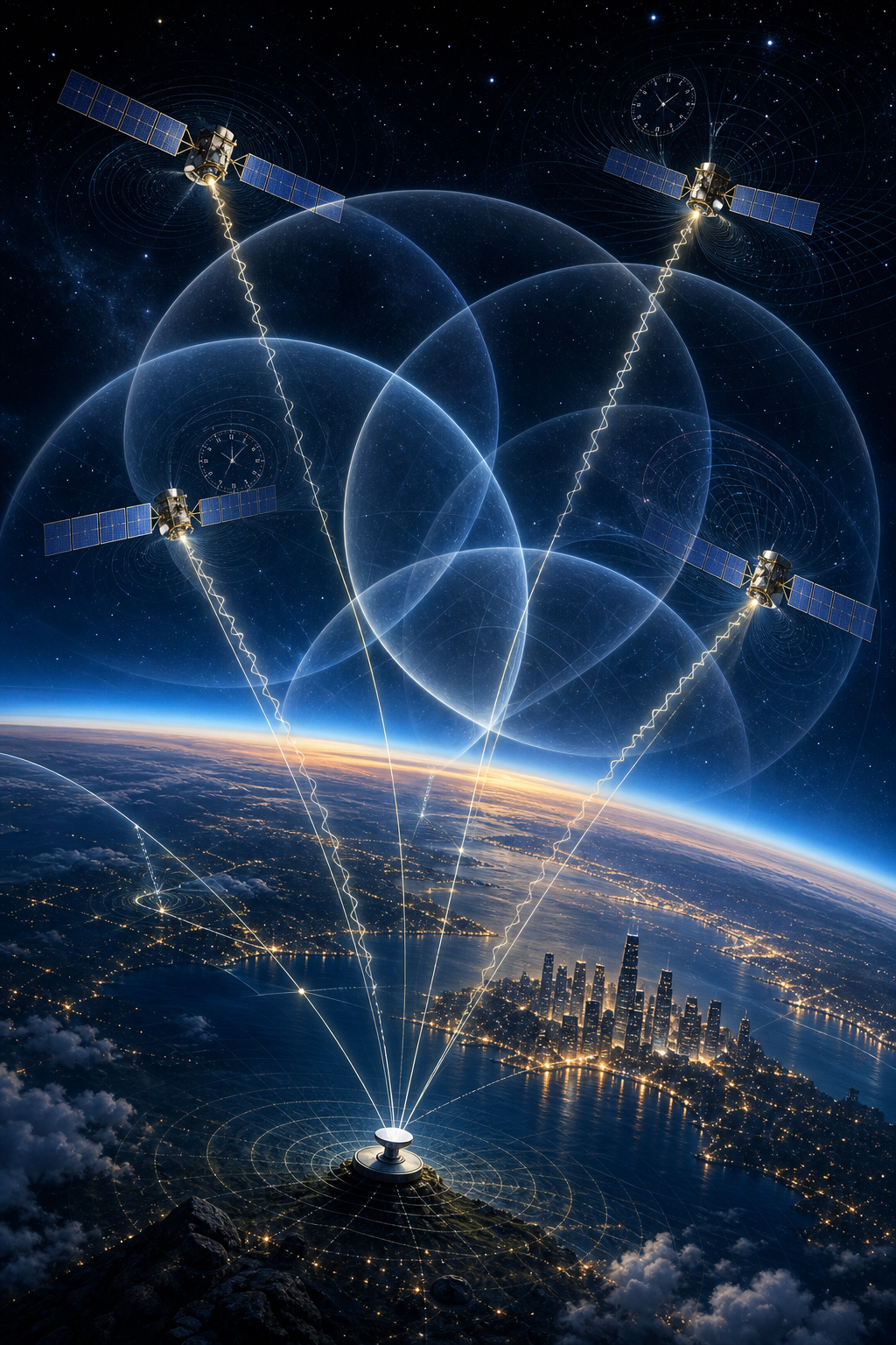
Now picture what one distance measurement means. If you know you are a certain distance from one satellite, you are not yet at one point on Earth. You could be anywhere on the surface of an invisible sphere centered on that satellite. A second satellite gives you a second sphere. The two spheres meet in a circle. A third satellite narrows the possibilities dramatically: in an idealized three-dimensional problem, the spheres intersect at a point.
That process is called trilateration. It is not triangulation. Triangulation uses angles. Trilateration uses distances.
But real GPS has a complication that makes a fourth satellite so important. The satellites carry atomic clocks, and their time is carefully maintained. Your phone does not. Its internal clock is useful, but it is nowhere near accurate enough to serve as a perfect reference for satellite ranging.
Suppose your receiver clock is a little fast. It will think every incoming signal took slightly longer to arrive than it really did. That makes every satellite appear farther away. If the receiver clock is slow, every satellite seems too close. These measured distances are therefore called pseudoranges: they are distance-like measurements that include clock error and other effects.
The receiver has four unknowns to solve for: its position in three dimensions — east-west, north-south, and height — plus its own clock offset. Four satellite signals provide four independent equations. Rather than needing an atomic clock in every phone, GPS lets the receiver solve for its timing mistake as part of the same calculation that solves its location. With signals from more satellites, the receiver has additional measurements that can improve the solution and help identify inconsistent data.
This explains a quiet miracle inside a navigation receiver. It is not simply reading coordinates sent down from space. It is comparing locally generated versions of satellite signal patterns with the patterns that arrive from orbit, estimating their delays, applying corrections, and searching for the single position-and-time solution that best fits them all.
For that to work, the satellites must be more than moving clocks. The receiver must know their positions very accurately. GPS satellites orbit in medium Earth orbit, roughly twenty thousand two hundred kilometers above Earth’s surface, and each circles Earth twice a day. Their transmitted navigation data includes orbital information that allows a receiver to determine where each satellite was when its particular signal was sent.
Still, satellite orbits and clocks cannot simply be set once and forgotten. That is the job of the control segment. Ground monitor stations around the world observe the satellites as they pass overhead. They gather navigation signals, range and carrier measurements, and atmospheric data. Their observations go to control facilities, which estimate satellite orbit and clock behavior, assess satellite health, and upload updated navigation information. When needed, satellites can also receive commands for maneuvers to maintain their proper orbits.
The clocks themselves deserve special attention. Atomic clocks do not keep time with gears, a swinging pendulum, or a vibrating quartz crystal. They use an extraordinarily stable frequency associated with atoms. In an atomic clock, electronics are tuned to a frequency that makes atoms change between defined energy states. The system detects when it is closest to that atomic resonance, then counts the steady cycles. Because atoms of the same kind behave alike, they provide a far more stable reference than ordinary mechanical or electronic oscillators.
GPS satellites carry multiple atomic clocks, and their timing is regularly corrected using still more accurate clocks on the ground. This matters because clock drift that sounds tiny in everyday life is disastrous for ranging. A timing error of one hundred billionths of a second would translate to about thirty meters at light speed. Precise time is not an optional refinement. It is the ruler GPS uses to measure space.
Even with excellent clocks, however, a GPS signal does not travel through a perfectly empty universe all the way to your phone. It passes through Earth’s atmosphere. The ionosphere, a region containing charged particles, can delay radio signals. The lower atmosphere, including the troposphere where weather occurs, also changes the signal’s travel time. Since GPS measures distance through timing, these delays can look like extra distance.
Receivers and the GPS system reduce these errors in several ways. Navigation messages provide correction information. Receivers can use models of atmospheric behavior. Dual-frequency techniques can help estimate and correct ionospheric delay because different radio frequencies are affected differently. Specialized augmentation systems and high-quality receivers can improve performance further.
Then there is multipath. This is the urban-canyon problem. A signal may arrive directly from a satellite, but another copy may bounce off a building, the ground, or another surface before reaching the antenna. The reflected signal takes a longer route. If the receiver mistakes some of that delayed energy for the direct signal, the timing measurement can be distorted. This is one reason location estimates can jump around near tall buildings, cliffs, or reflective structures.
Satellite geometry matters too. Four satellites crowded into one patch of sky do not constrain position as well as four satellites spread widely across it. A receiver benefits when its visible satellites surround it from different directions, because errors then have less opportunity to stretch the final position estimate in one particular direction.
And beneath all this engineering sits an idea that once sounded purely theoretical: relativity.
Einstein’s special relativity says that a moving clock runs more slowly relative to a stationary observer. GPS satellites move quickly around Earth, so this effect makes their clocks run slower than clocks on the ground by about seven microseconds per day.
General relativity adds the opposite effect. Gravity affects the rate at which time passes: clocks in weaker gravity run faster than clocks in stronger gravity. GPS satellites are far above Earth’s surface, where gravity is weaker than on the ground. That makes their clocks run faster by about forty-five microseconds per day.
Put the two effects together, and the clocks aboard GPS satellites would run about thirty-eight microseconds per day faster than comparable clocks on Earth if the system did nothing about it. Thirty-eight microseconds may seem trivial. For GPS, it is enormous. Left uncorrected, that timing mismatch would make calculated positions drift rapidly. GPS works because relativity is built into its timing design and corrections.
So the blue dot on your screen rests on a chain of reasoning that reaches from quantum behavior inside atoms to Einstein’s description of time, from ground stations to satellites high above Earth, and from radio waves to geometry.
GPS does not find you by looking down and recognizing a street corner. It finds you by listening to several spacecraft say, with astonishing precision, where they were and when they spoke. Your receiver measures how long their words took to reach it, corrects for imperfect clocks and imperfect paths through the world, and turns time into distance, distance into geometry, and geometry into a place.
The memorable part is this: whenever GPS shows you where you are, it is also demonstrating that time is not just something we read. With enough precision, time becomes a way to measure the shape of space itself.